Kraj

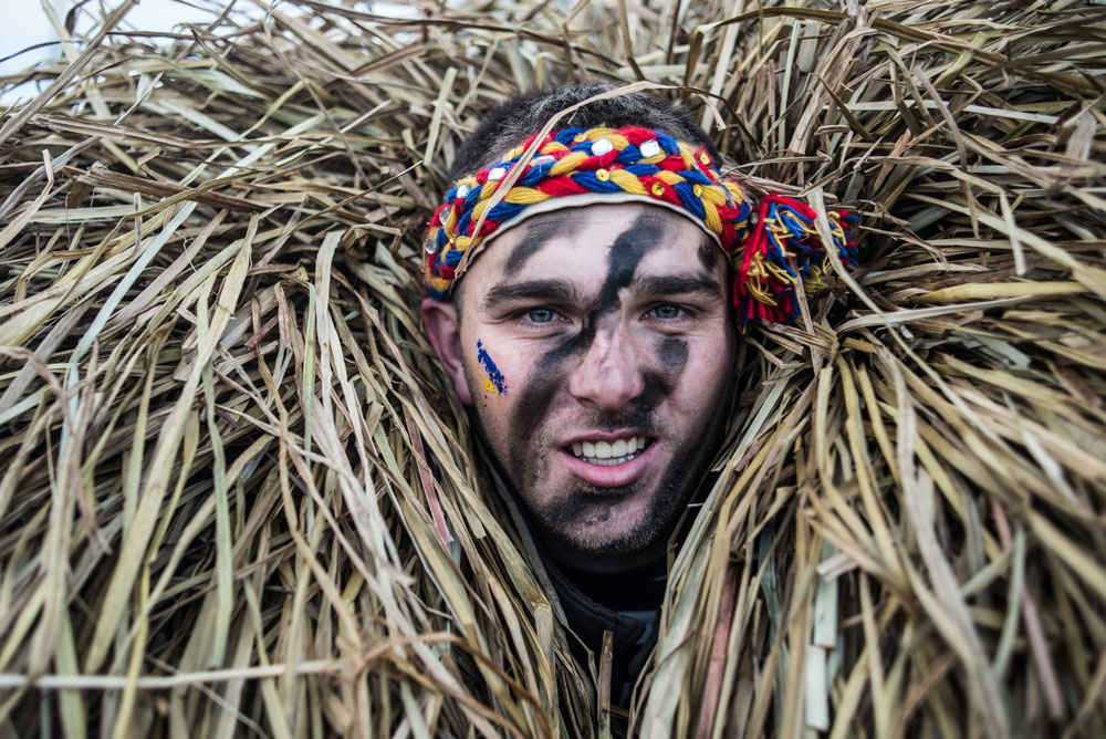
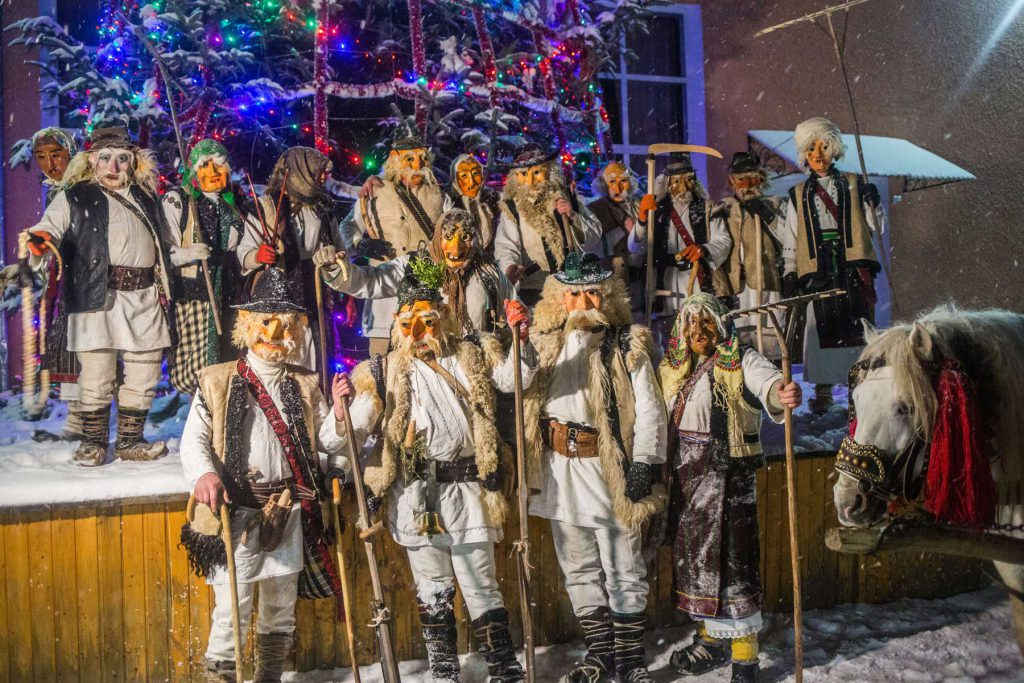
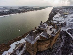
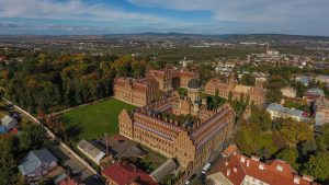
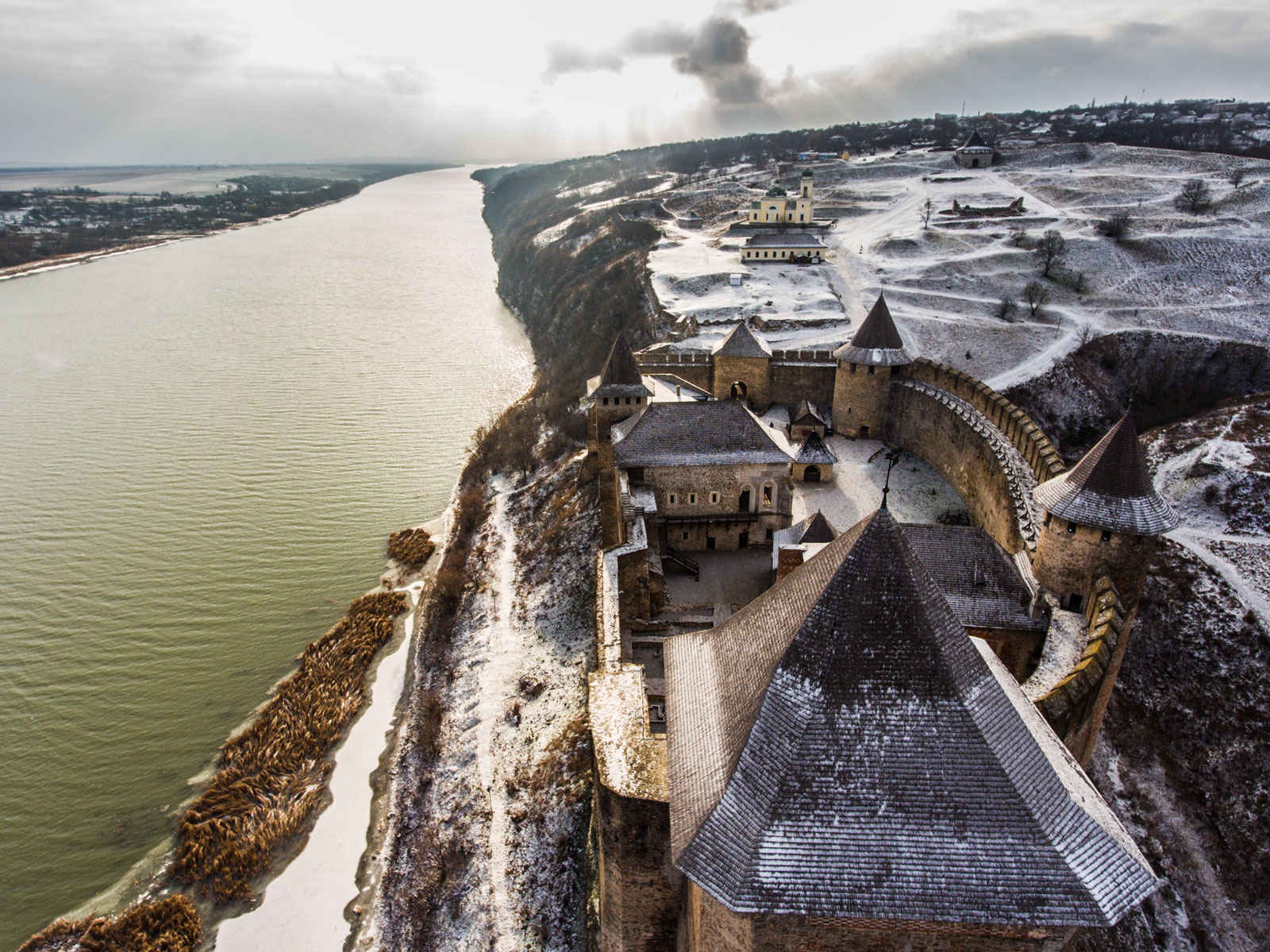
Historický region, který se nachází mezi středním Dnistrem (Dněstrem) a hlavním hřbetem Karpat, v údolích na tocích řek Prut a Siret. Právě tady je možné jednou ročně vidět blýskavé oslavy svátku Malanky ve vesnici Krasnojiľs'k a také zkusit přejet Dnister trajektem. Hlavními symboly turistiky se stala hlavní budova Černivecké univerzity, veliká Chotyň'ská pevnost na Dnistru a skutečná kozácká sič v Červené Dibrovi.

příběhů 3
míst 4

Příběhy

Místa

Malanka in Krasnoilsk

Ukrainer was the first media project to stream Malanka 2018. More than 400 thousand viewers followed this event. Every year the village of Krasoilsk turns into a real carnival for two days. Take a look at a short video how it was last winter.

Share this...
Facebook
Twitter
Kraj
ukrainer-map-large

Krasnoilsk

Místo na Google Mapách

Tomnatyk. “Pamir” Radar

5 white domes are hiding in Bukovyna Carpathians. They were providing control over air border of the USSR. The remains of the station with code name "Pamir" are still crowning the top of Tomnatyk mountain on the border with Romania.

Share this...
Facebook
Twitter
Kraj
ukrainer-map-large

Verkhniy Yalovets

Místo na Google Mapách

The Khotyn Fortress

The Khotyn Fortress has been defending an important trade and customs center on the river Dnister. At different times it was residence for Turkish and polish soldiers, cossacks and hetmans. Nowadays it attracts tourists from all over the world.

Share this...
Facebook
Twitter
Kraj
ukrainer-map-large

Khotyn

Místo na Google Mapách

Chernivtsi National University

The architectural complex of Chernivtsi National University made its way through times as a residence of metropolitans and into a shrine of knowledge and UNESCO world heritage spot. Take a look at the unique complex of the Chernivtsi National University.

Share this...
Facebook
Twitter
Kraj
ukrainer-map-large

Chernivtsi National University

Místo na Google Mapách

Ukrainer podporují

Stát se partnerem

Sleduj Expedici