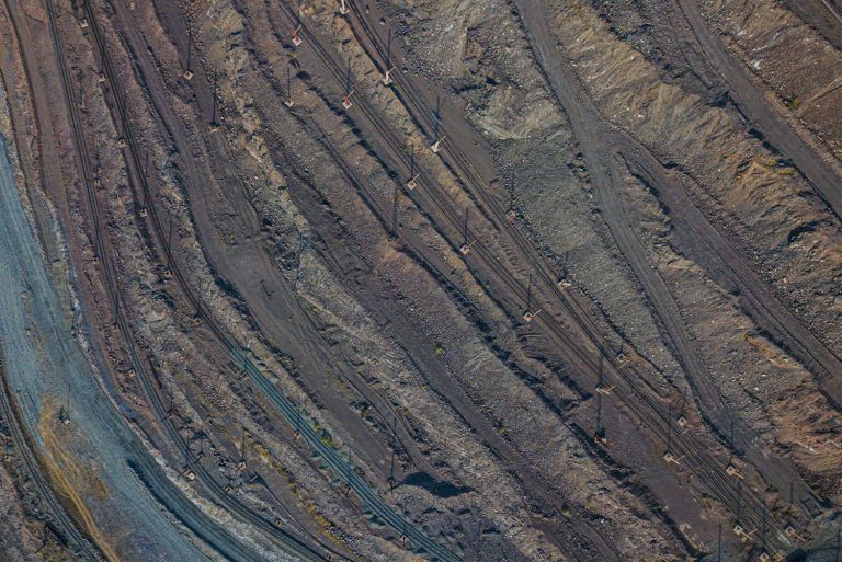
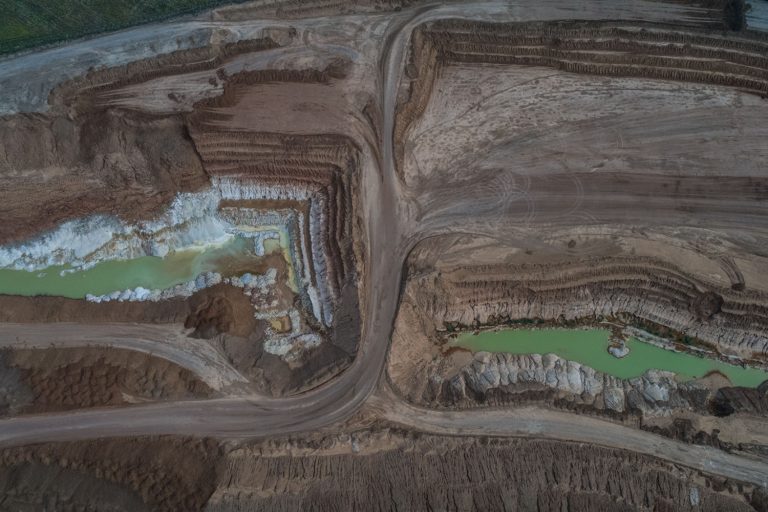
Iron ore quarry in Kryvyi Rih is one of the biggest in the world. It is a significant landmark of industrial tourism.

Dzharylhach is the largest uninhabited island in Ukraine located in the Karkinit Bay, the Black Sea.

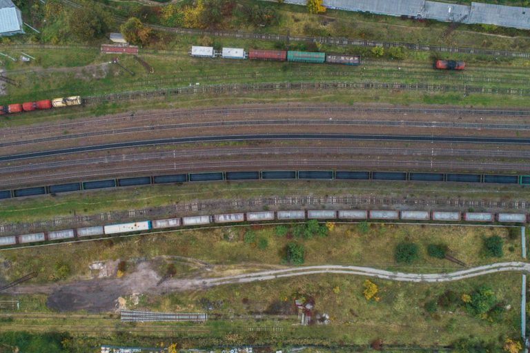
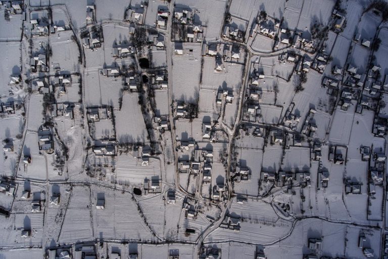
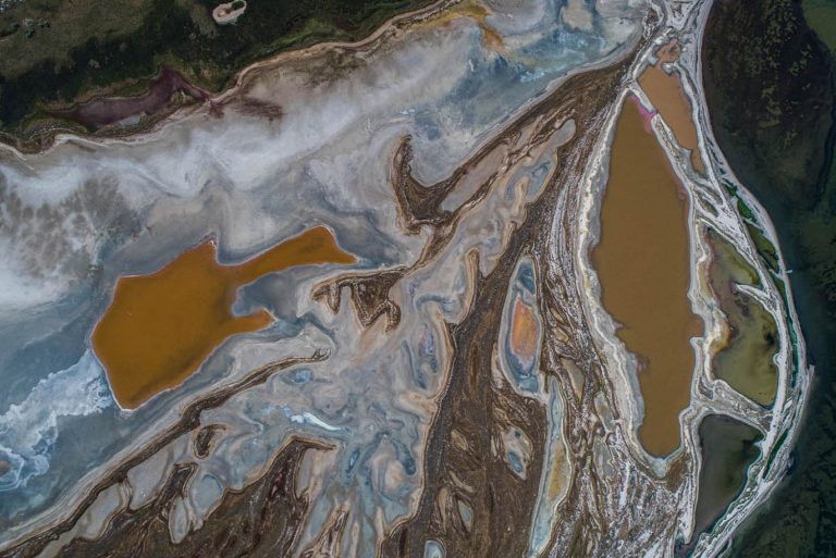
The fire clay extraction quarry near Rohanske village, between Sloviansk and Dobropillia. Recently local activists have been creating a chain of public spaces to make the town more interesting and authentic.

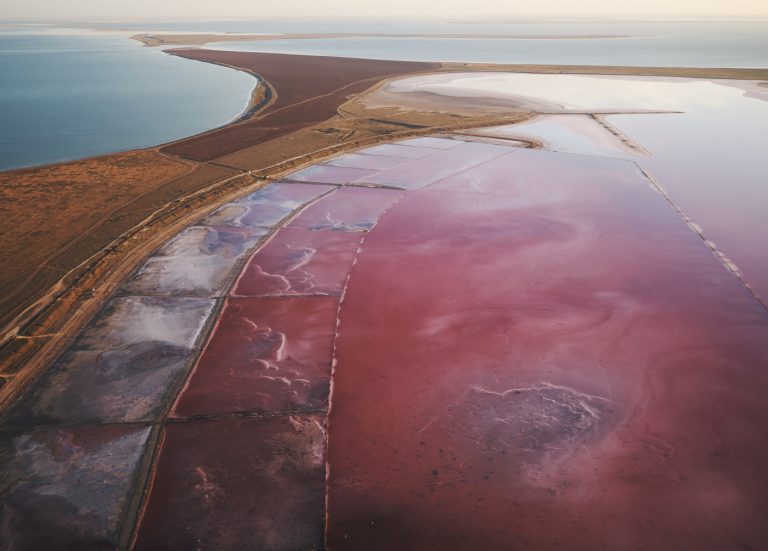
The conservation areas of the Tuzly Estuaries National Park cover the chain of thirteen estuaries in the inter stream of Danube and Dnister in Bessarabia.

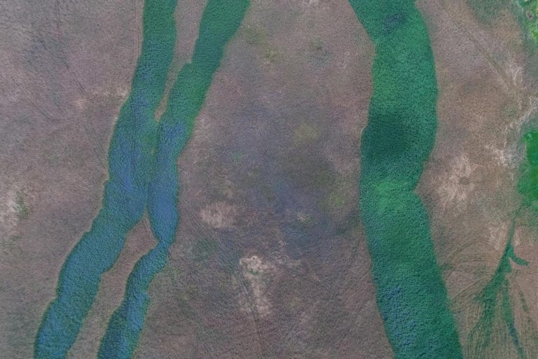
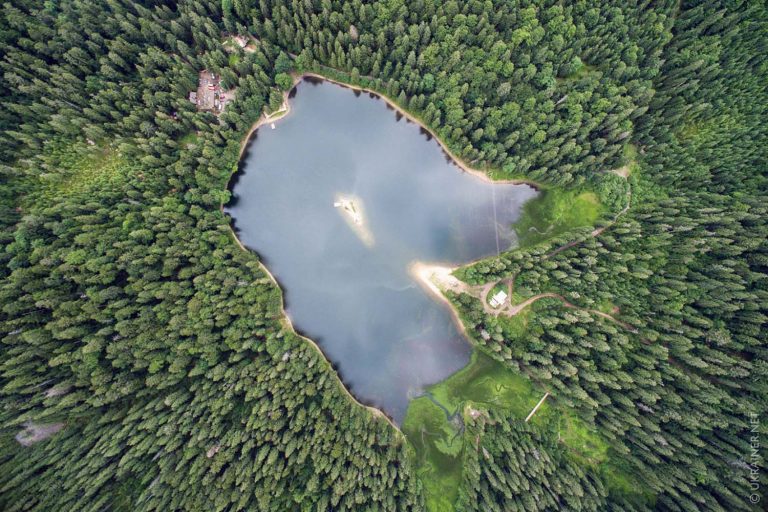
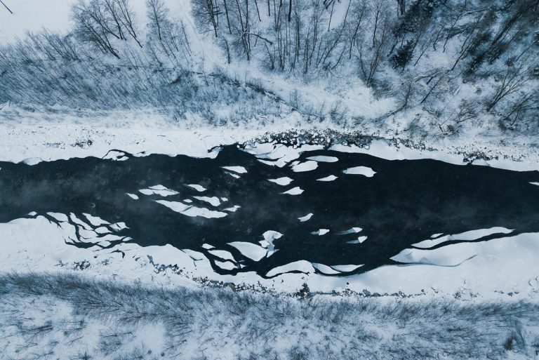
Holubi or Blakytni (Blue) lakes are a popular recreational location 27 kilometres from Sloviansk. They are located amidst pine tree forest near the river Siverskyi Donets. The lakes used to be sand quarries that filled up with spring waters with the course of time.

Kinburn Spit is a sandy spit located in the north-west of the Kinburn peninsula between the Black Sea and the Dnipro-Buh estuary. It is part of the Black Sea Biosphere Reserve.

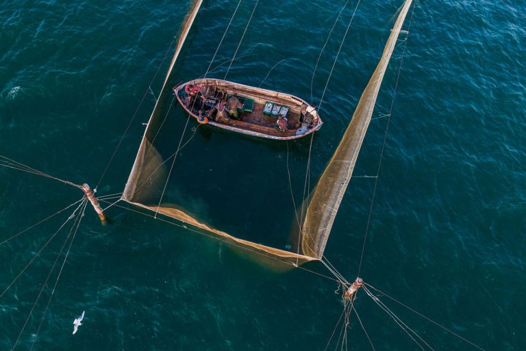
Fishermen are checking the stationary seines near the village Prymorske (earlier known as Shagany) in Bessarabia.

Adzyhol Lighthouse is the tallest in Ukraine. It is located near the village Rybalche, Tavria, near the southeastern shore of the Dnipro-Buh estuary.

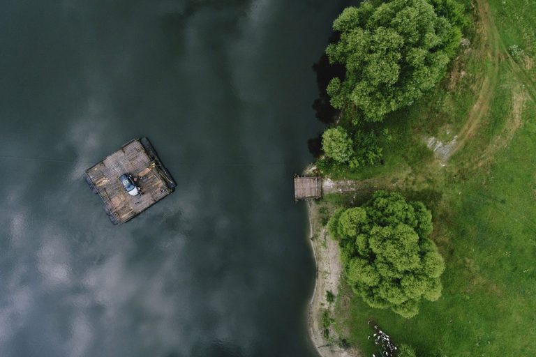
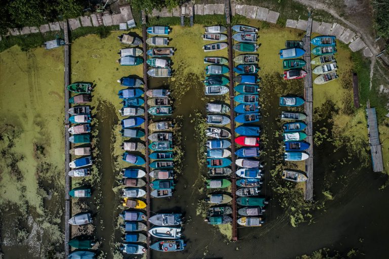
A boating station in the town Rzhyshchiv, Naddniprianshchyna.

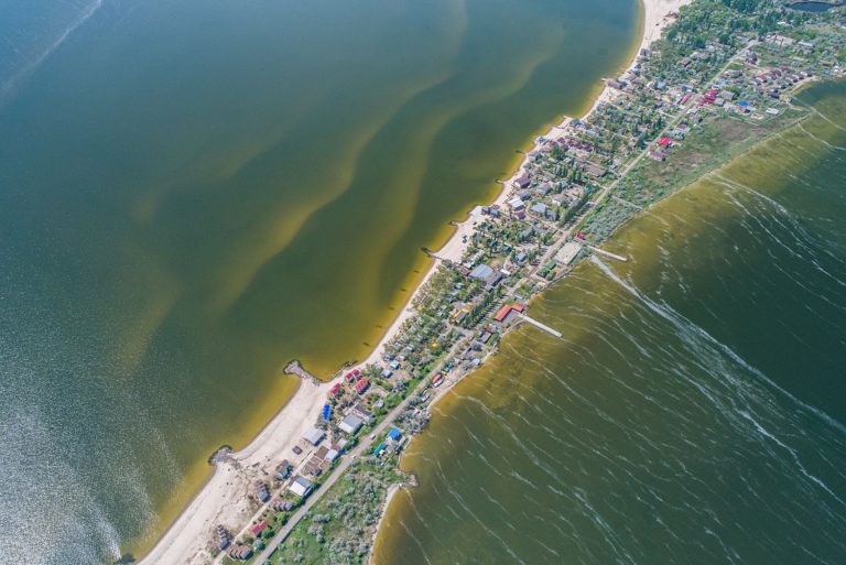
The village Chornomorka is washed by Dnipro-Buh estuary from the west and Berezan estuary from the northwest. It is located five kilometers from Ochakiv and sixty-five kilometres from Mykolaiv.

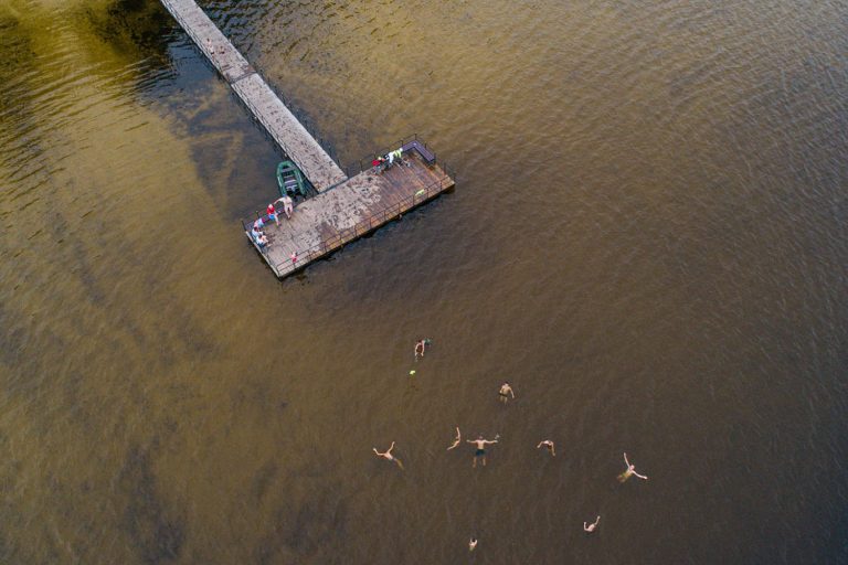
A beach on the bank of the river Ros in Bila Tserkva, Naddniprianshchyna.

A beach on the river Kharkiv near the Saltivskyi residential district located in the city Kharkiv.

A public garden at the merge of the rivers Kharkiv and Lopan.

The coastal part of the city Mykolaiv, Prychornomoria.

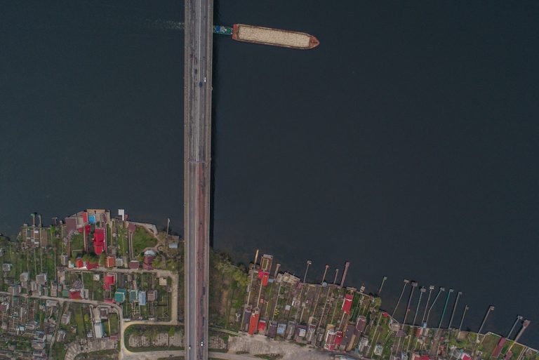
Antonivskyi motorway bridge in Kherson connects the city with the left bank of the river Dnipro, the towns Oleshky and Hola Prystan.

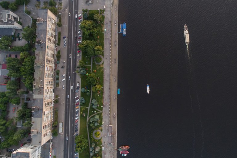
Sicheslav riverfront is located in the central part of the city Dnipro in Podniprovia and Zaporizhzhia region.

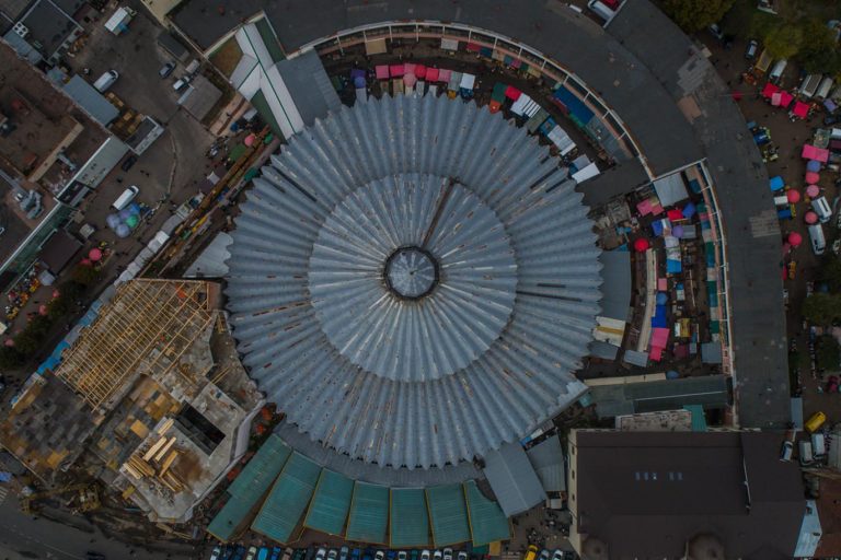
The central market of Ivano-Frankivsk in Halychyna.

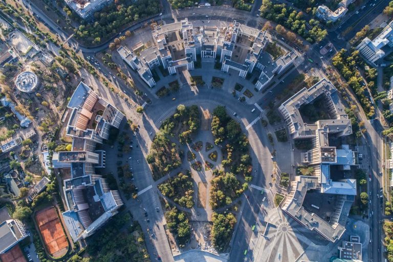
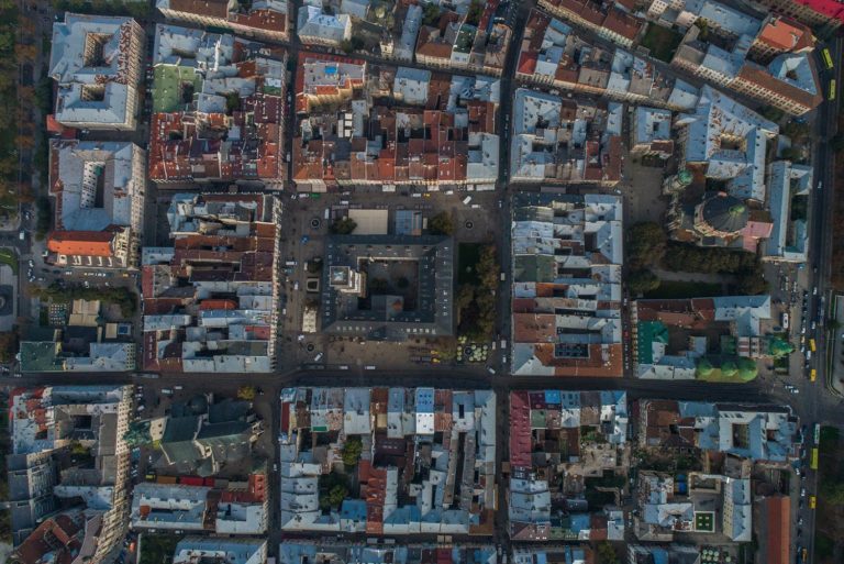
The city center of Lviv is on the UNESCO world heritage list.

Due to its proximity to freshwater, favorable climate and team spirit of its inhabitants the village Utkonosivka in Bessarabia is one of the biggest rural producers of tomatoes in Ukraine.

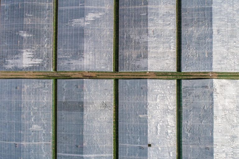
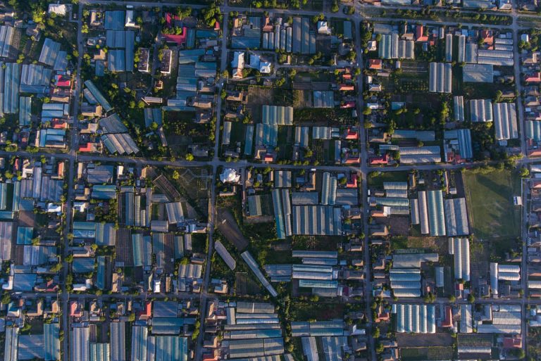
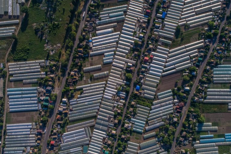
Greenhouse households are the foundation of economics in the village Vodiane in Podniprovia and Zaporizhzhia.

The building of State Industry (Derzhprom) in the center of Kharkiv is the first soviet times 13-storey skyscraper.

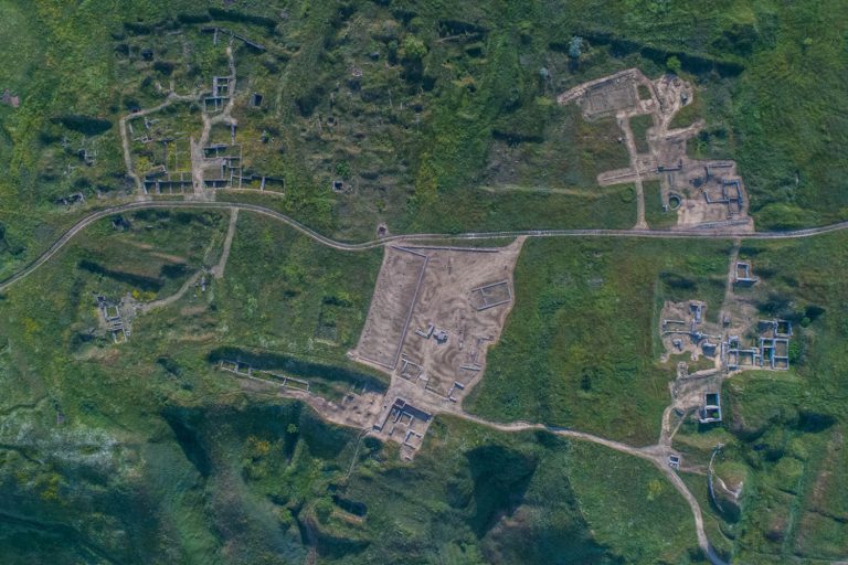
The National Historical and Archaeological Reserve “Olbia” is a complex of historical monuments of the ancient cognominal polis near the village Parutyne, Prychornomoria. The major portion of the museum’s exposition consists of the remains of the antique architecture under the open sky.

Private houses in one of the villages in Troitska Hromada near the border with Russia. Since 2017 the inhabitants have been learning to be fully responsible for their area and implement vitally important projects.

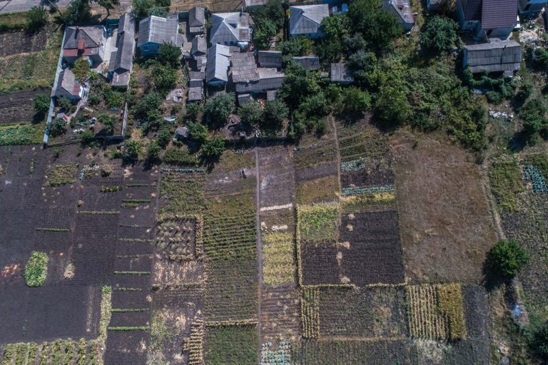
Households in Volyn village Khorokhoryn, where the majority of inhabitants grow napa cabbage and strawberries.

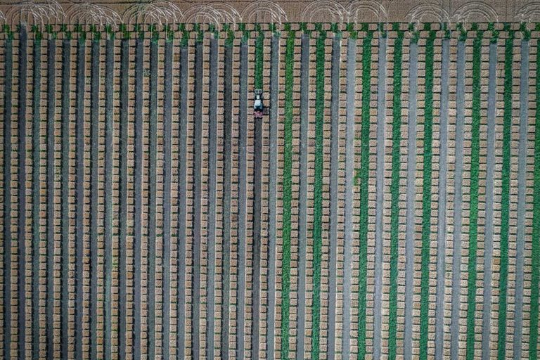
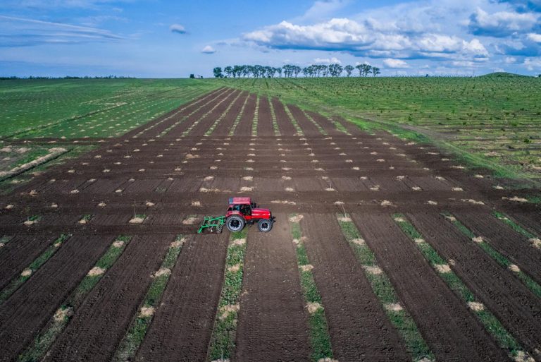
A tractor is cultivating a field next to the city of Cherkasy, Naddniprianshchyna.

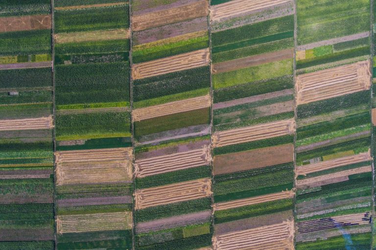
Agricultural fields near the town Zalishchyky, Podillia.

A great number of bird species nest on Bilosaraisk spit due to favorable geographical position, numerous shallow estuaries and lakes.

Bilosaraisk spit forms a peninsula in the Ukrainian aquatic area of the Azov Sea. In 1995 Bilosaraisk wildfowl reserve was founded here.

On the bank of the river Turunchuk in the village Troitske, Prychornomoria, a farmer Pavlo Tulba cultivates walnuts, hazelnuts and briar.

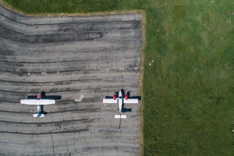
A runway near the village Shyroke, Pryazovia, where they assemble light aircraft for agricultural needs.

Agrotourism complex “Kremenivskyi Straus” (Kremeniv Ostrich) located in the village Kremeniv, Prychornomoria.

A riverbank of South Buh, the village Tyvriv, Podillia.

The village Marianivka is located on the coast of Tylihul estuary in Prychirnimoria.

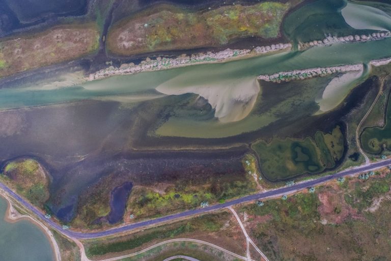
Tylihul spit in the south of Ukraine got formed when the sea flooded lowlands of the river Tylihul. The estuary is separated from the Black Sea by a sandy mound covered in salt marshes and tiny lakes.

The river Perebiyna is the right tributary of the river Konka in the lower course of Dnipro. The Dnipro river bed splits into numerous arms with a great many flood plains and lakes.

The shore of the Dnipro-Buh estuary near the village Vynohradne, Tavria.

Railway tracks next to the creative complex !FESTrepublic that appeared on the spot of the abandoned factory near the park Znesinnia in Lviv.

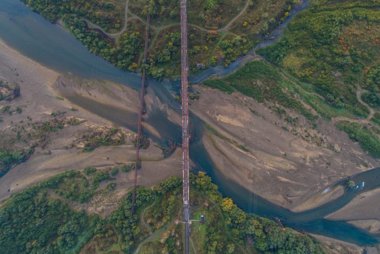
A bridge across the river Stryi near the like-named town in Halychyna.

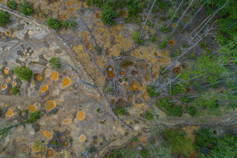
Amber mines near the village Volodymyrets, Polissia.

White Lake near the village Rudka. This area is characterized by a unique combination of swamp, lake and forest natural complexes of the Western Polissia.

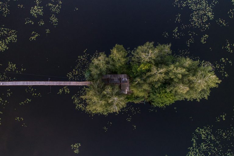
A fisherman's house on an artificial island amidst the river Kodnianka in the village Staryi Solotvyn, Volyn.

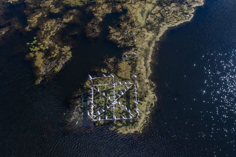
Birds on the bank of the river Ikopot that is running through the town Starokostiantyniv in Volyn and feeding into the river Sluch.

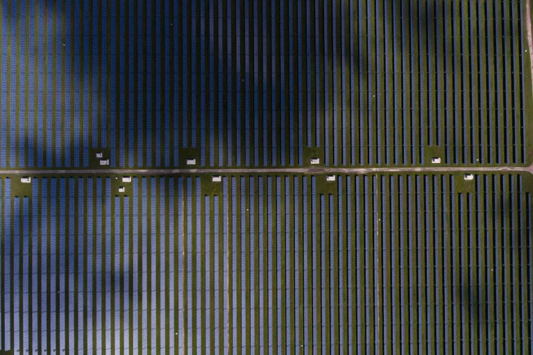
A photovoltaic power station next to the village Starokozache in Bessarabia.

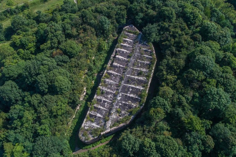
Tarakaniv fort is a 19th-century defence structure, located near village Tarakaniv, Volyn, in a picturesque spot above the river Ikva.

Mezynskyi National Nature Park. Numerous ferries travel between settlements on the banks of the river Desna.

The largest lake in Ukrainian Carpathians Synevyr is located in mountain group Inner Gorgany. It is part of the National natural preserve “Synevyr”.

The Henichesk lake located in the north of the Arabat Spit, in Pryazovia, is saturated with valuable minerals. It is a salt lake of the firth origin that fills up with waters of Syvash.

Greenhouses in the village Dobropasove in Podniprovia and Zaporizhzhia. Several generations of village inhabitants have been growing and selling cucumbers.

The village Krasnoilsk is located on the border with Romania and hosts each year the biggest and most famous Malanka celebration in Bukovyna.

The river Chornyi Cheremosh flows through the village Kryvorivnia, where the tradition of koliada is a part of Christmas celebrations since the pre-Сhristian times.

Humanity has always dreamt of flying. Due to the development of civil aviation, we can take off in the skies and see the world from a plane. Improvement of quadcopters enabled us to photograph every corner of the Earth from the bird’s eye view. Photographers are in constant search of new angles to look at everyday things. On the pictures by our photographers, you will see Ukraine from the angles that might not be identified by your eyes at once.
Iron ore quarry in Kryvyi Rih is one of the biggest in the world. It is a significant landmark of industrial tourism. Photo: Oleksandr Khomenko
Dzharylhach is the largest uninhabited island in Ukraine located in the Karkinit Bay, the Black Sea. Photo: Pavlo Pashko
The fire clay extraction quarry near Rohanske village, between Sloviansk and Dobropillia. Recently local activists have been creating a chain of public spaces to make the town more interesting and authentic. Photo: Pavlo Pashko
The conservation areas of the Tuzly Estuaries National Park cover the chain of thirteen estuaries in the inter stream of Danube and Dnister in Bessarabia. Photo: Pavlo Pashko
Holubi or Blakytni (Blue) lakes are a popular recreational location 27 kilometres from Sloviansk. They are located amidst pine tree forest near the river Siverskyi Donets. The lakes used to be sand quarries that filled up with spring waters with the course of time. Photo: Pavlo Pashko
Kinburn Spit is a sandy spit located in the north-west of the Kinburn peninsula between the Black Sea and the Dnipro-Buh estuary. It is part of the Black Sea Biosphere Reserve. Photo: Pavlo Pashko
Fishermen are checking the stationary seines near the village Prymorske (earlier known as Shagany) in Bessarabia. Photo: Pavlo Pashko
Adzyhol Lighthouse is the tallest in Ukraine. It is located near the village Rybalche, Tavria, near the southeastern shore of the Dnipro-Buh estuary. Photo: Pavlo Pashko
A boating station in the town Rzhyshchiv, Naddniprianshchyna. Photo: Pavlo Pashko
The village Chornomorka is washed by Dnipro-Buh estuary from the west and Berezan estuary from the northwest. It is located five kilometers from Ochakiv and sixty-five kilometres from Mykolaiv. Photo: Pavlo Pashko
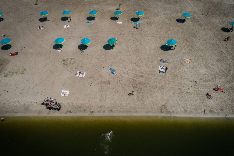
A beach on the bank of the river Ros in Bila Tserkva, Naddniprianshchyna. Photo: Pavlo Pashko
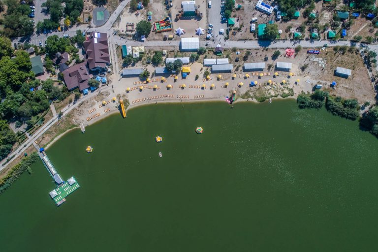
A beach on the river Kharkiv near the Saltivskyi residential district located in the city Kharkiv. Photo: Pavlo Pashko
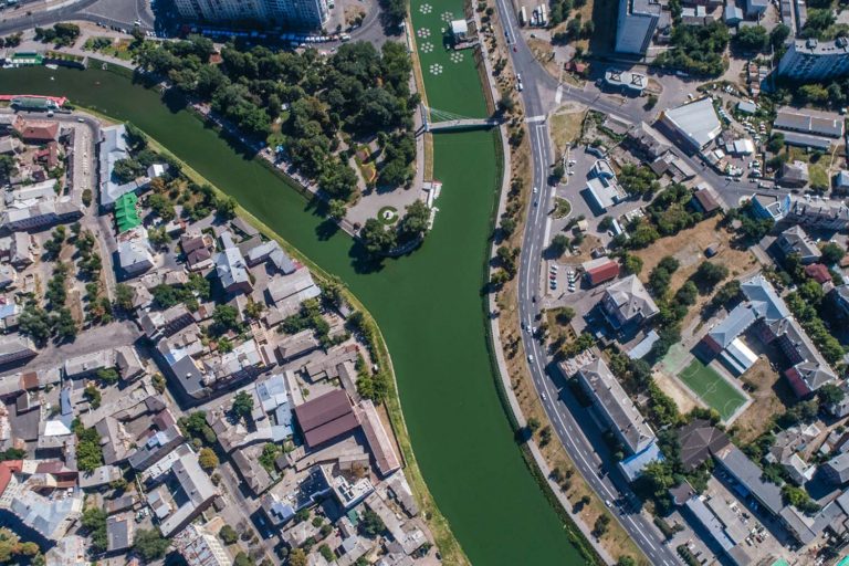
A public garden at the merge of the rivers Kharkiv and Lopan. Photo: Pavlo Pashko
The coastal part of the city Mykolaiv, Prychornomoria. Photo: Pavlo Pashko
Antonivskyi motorway bridge in Kherson connects the city with the left bank of the river Dnipro, the towns Oleshky and Hola Prystan. Photo: Pavlo Pashko
Sicheslav riverfront is located in the central part of the city Dnipro in Podniprovia and Zaporizhzhia region. Photo: Pavlo Pashko
The central market of Ivano-Frankivsk in Halychyna. Photo: Pavlo Pashko
The city center of Lviv is on the UNESCO world heritage list. Photo: Pavlo Pashko
Due to its proximity to freshwater, favorable climate and team spirit of its inhabitants the village Utkonosivka in Bessarabia is one of the biggest rural producers of tomatoes in Ukraine. Photo: Pavlo Pashko
Greenhouse households are the foundation of economics in the village Vodiane in Podniprovia and Zaporizhzhia. Photo: Pavlo Pashko
The building of State Industry (Derzhprom) in the center of Kharkiv is the first soviet times 13-storey skyscraper. Photo: Pavlo Pashko
The National Historical and Archaeological Reserve “Olbia” is a complex of historical monuments of the ancient cognominal polis near the village Parutyne, Prychornomoria. The major portion of the museum’s exposition consists of the remains of the antique architecture under the open sky. Photo: Pavlo Pashko
Private houses in one of the villages in Troitska Hromada near the border with Russia. Since 2017 the inhabitants have been learning to be fully responsible for their area and implement vitally important projects. Photo: Pavlo Pashko
Households in Volyn village Khorokhoryn, where the majority of inhabitants grow napa cabbage and strawberries. Photo: Pavlo Pashko
A tractor is cultivating a field next to the city of Cherkasy, Naddniprianshchyna. Photo: Pavlo Pashko
Agricultural fields near the town Zalishchyky, Podillia. Photo: Pavlo Pashko
A great number of bird species nest on Bilosaraisk spit due to favorable geographical position, numerous shallow estuaries and lakes. Photo: Pavlo Pashko
Bilosaraisk spit forms a peninsula in the Ukrainian aquatic area of the Azov Sea. In 1995 Bilosaraisk wildfowl reserve was founded here. Photo: Pavlo Pashko
On the bank of the river Turunchuk in the village Troitske, Prychornomoria, a farmer Pavlo Tulba cultivates walnuts, hazelnuts and briar. Photo: Pavlo Pashko
A runway near the village Shyroke, Pryazovia, where they assemble light aircraft for agricultural needs. Photo: Pavlo Pashko
Agrotourism complex “Kremenivskyi Straus” (Kremeniv Ostrich) located in the village Kremeniv, Prychornomoria. Photo: Pavlo Pashko
A riverbank of South Buh, the village Tyvriv, Podillia. Photo: Pavlo Pashko
The village Marianivka is located on the coast of Tylihul estuary in Prychirnimoria. Photo: Pavlo Pashko
Tylihul spit in the south of Ukraine got formed when the sea flooded lowlands of the river Tylihul. The estuary is separated from the Black Sea by a sandy mound covered in salt marshes and tiny lakes. Photo: Pavlo Pashko
The river Perebiyna is the right tributary of the river Konka in the lower course of Dnipro. The Dnipro river bed splits into numerous arms with a great many flood plains and lakes. Photo: Pavlo Pashko
The shore of the Dnipro-Buh estuary near the village Vynohradne, Tavria. Photo: Pavlo Pashko
Railway tracks next to the creative complex !FESTrepublic that appeared on the spot of the abandoned factory near the park Znesinnia in Lviv. Photo: Pavlo Pashko
A bridge across the river Stryi near the like-named town in Halychyna. Photo: Pavlo Pashko
Amber mines near the village Volodymyrets, Polissia. Photo: Pavlo Pashko
White Lake near the village Rudka. This area is characterized by a unique combination of swamp, lake and forest natural complexes of the Western Polissia. Photo: Pavlo Pashko
A fisherman's house on an artificial island amidst the river Kodnianka in the village Staryi Solotvyn, Volyn. Photo: Pavlo Pashko
Birds on the bank of the river Ikopot that is running through the town Starokostiantyniv in Volyn and feeding into the river Sluch. Photo: Pavlo Pashko
A photovoltaic power station next to the village Starokozache in Bessarabia. Photo: Pavlo Pashko
Tarakaniv fort is a 19th-century defence structure, located near village Tarakaniv, Volyn, in a picturesque spot above the river Ikva. Photo: Pavlo Pashko
Mezynskyi National Nature Park. Numerous ferries travel between settlements on the banks of the river Desna. Photo: Pavlo Pashko
The largest lake in Ukrainian Carpathians Synevyr is located in mountain group Inner Gorgany. It is part of the National natural preserve “Synevyr”. Photo: Dmytro Ochrimenko
The Henichesk lake located in the north of the Arabat Spit, in Pryazovia, is saturated with valuable minerals. It is a salt lake of the firth origin that fills up with waters of Syvash. Photo: Pavlo Pashko
Greenhouses in the village Dobropasove in Podniprovia and Zaporizhzhia. Several generations of village inhabitants have been growing and selling cucumbers. Photo: Pavlo Pashko
The village Krasnoilsk is located on the border with Romania and hosts each year the biggest and most famous Malanka celebration in Bukovyna. Photo: Pavlo Pashko
The river Chornyi Cheremosh flows through the village Kryvorivnia, where the tradition of koliada is a part of Christmas celebrations since the pre-Сhristian times. Photo: Dmytro Bartosh